

“It’s giving colonialism”: Ireland still owes rent to dukes and earls
Although, even though the OPW lists these rents as payable, some of the named beneficiaries say they haven't been getting them.
Changes include a buffer aimed at reducing the project's impact on neighbouring Finglas – and density reductions expected to shave off thousands of homes.

A new version of Fingal's plan for a new town at Dunsink that councillors approved on Thursday evening includes significant changes, including several in response to concerns of Finglas residents.
The development is planned for a 435-hectare area inside the M50, north of Castleknock, and west of Finglas – including the old landfill as a park, not for residential development.
Fingal County Council had put a version of the plan out for public consultation in June, and in response got a flood of more than 1,000 submissions from state bodies, businesses and local residents.
Among those were some from residents concerned about plans to allow the construction of multi-storey apartment buildings bordering neighbourhoods east of Dunsink, around Westwood Avenue, Woodbank Avenue, Valley Park Road.
And some from residents concerned about the prospect of years of construction traffic running through their residential neighbourhoods on the way to building thousands of homes, as well as schools, shops, parks, greenways, and more.
Over the course of four days of marathon meetings this week, some lasting more than six hours, councillors worked through a 240-item agenda of changes from themselves and from council planners and executives.
The changes were meant, executives and councillors said, to address concerns about the new construction of the new Dunsink town's impacts on surrounding areas, the environment, and biodiversity, as well as making it a more sustainable and liveable place.
During the meetings this week, councillors approved proposals from the council executive for more of a buffer between the eastern edge of the Dunsink town and established residential neighbourhoods next door, and to better control construction traffic during the years it is being built out.
They also approved changes to reduce the planned housing density in the area – though not as much as some councillors wanted – and lower allowable heights of buildings in some places. Those and other changes meant reducing the range of homes expected to be built at Dunsink from the June figure of between 17,500 and 18,400, to between 5,400 and 15,000.
And on Thursday night, Fingal councillors backed a motion from Solidarity Councillor John Burtchaell amending the Dunsink Urban Area Plan to block own-door and duplex homes built there from being sold in bulk to commercial institutional investors.
As well as another motion from Burtchaell that none of the homes build on publicly owned lands at Dunsink should ever be sold off to "corporate/commercial landlords".
The plan envisions the town being built out in three phases, with the council, state bodies, and private developers applying for planning permission for each housing, recreational or infrastructure project.
This week, Roisin Burke, Fingal’s director of planning and development, said the council wants to have the 2,500 homes in Phase 1 permitted and under construction by 2029. But there's a prospect that Phases 2 and 3 could be significantly delayed.
The extension of the Luas to the new town is a key part of the strategy for helping thousands of new residents who move in there get to and from their homes.
But the National Transport Authority currently has the Tyrrelstown scheme indicated as “post-2042 project” and some councillors worried where that'd leave Dunsink residents in the intervening years.
This week, councillors backed a motions from Green Party Councillor David Healy and Labour Party Councillor John Walsh that a Luas Tyrrelstown extension "under construction or operational" be provided in Phase 2. That could stop development at that point to await the Luas, said Burke, the council planning director.
Also, Uisce Éireann, in a submission to the public consultation over the summer, said that "full development of Phases 2 & 3 will be reliant on delivery of the WSP [Water Supply Project] and GDD [Greater Dublin Drainage] projects", noting that the GDD has planning and could be operational by 2032, but the WSP does not yet even have planning.
 Sam Tranum
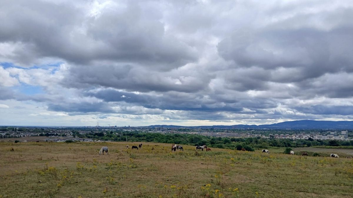
The section of the planned Dunsink town that borders established residential areas most directly is called Dunsink East.
On its 57 hectares the plan envisions a "core residential" part of the new town, which the June plan said would have maybe 6,500 to c.6,800 new homes, and revisions this week would bring down to about 1,900 to 5,700.
The version of the plan published in June and put out for public consultation showed a "gateway" towers of 15+ storeys near the junction of Dunsink Lane and Ratoath Road, and at a site west of Scribblestown Avenue and north of Scribblestown Lane.
It also shows a block of homes of up to six storeys, east of the Scribblestown Stream and just immediately west of two-storey homes along Woodbank Drive and Valley Park Drive.
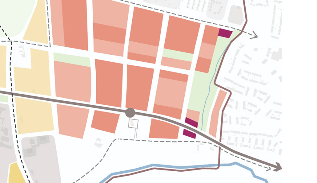
After reviewing the submissions to the public consultation over the summer, the chief executive's report circulated to councillors on 11 September proposed changes.
"Submissions raise concerns regarding the scale and height of development along the eastern boundary adjoining existing residential areas in Finglas and consider that taller buildings could adversely affect residential amenity, visual amenity and the character of established neighbourhoods," the report says.
The executive recommended that councillors adopt a series of changes to the plan to respond to this, which they did at their meeting on Tuesday.
This included "Remove gateway building designation from blocks shown and replace with height of 2-6 storeys height for the Dunsink East development".
As well as omitting "the block along the eastern boundary of the Plan lands with Woodbank, Valley Park Road and Scribblestown Avenue residential developments and replace it with open space". And omitting "the block at the northeast corner of Dunsink Lane, adjacent to Westwood Road".
And ensuring "Ensure that future development proposals incorporate an appropriate interface with existing residential areas, ensuring that building height, scale, massing and layout are carefully designed to protect residential amenity".
Another theme of the submissions to the public consultation was concern among residents near Dunsink, that they might have to suffer with the noise, dust, and danger of construction traffic passing through for many years.
"Several submissions objected to the use of Scribblestown Lane, Dunsinea Lane, Ratoath Road and other local roads for construction traffic, citing existing congestion, constrained road conditions and road safety concerns," the chief executive's 11 September report says.
"It was argued that these routes are unsuitable for significant construction traffic and could adversely affect nearby residents, schools, nursing homes, pedestrians, cyclists and emergency vehicle access," it says. And so many submissions requested construction traffic access the lands "primarily via the strategic road network, including the N3 and M50", it said.
It doesn't make sense for the Dunsink Urban Area Plan to set out now the construction routes that'll be used at every stage, since the whole project area and its transport network will be changing over time, the report says.
Instead, the already plan required "the submission of Construction Traffic Management Plans for development proposals that have the potential to generate significant construction traffic", the September report said.
These are meant to address construction vehicle routing, traffic management, pedestrian and cyclists safety, noise and dust mitigation, hours of operation, and more, it said.
But the report recommended that the plan be amended to "indicate that construction traffic should utilise to the strategy road network including the N3, M50 and Dunsink Lane to the greatest extent possible in order to minimise impacts on existing residential areas".
Councillors adopted that recommendation about four hours into their meeting on Monday.
"I think the chief executive has gone a long way to meet the concerns [about construction traffic] that were raised in the public consultation," said Walsh, the Labour councillor, but he introduced a motion to specifically name Scribblestown Lane and Dunsinea Lane as local residential streets that construction traffic should avoid.
Fallon said that this was already covered by what had come before.
"The text that is recommended to be included has addressed this matter," she said, "and recommended that the strategic road network be used where at all possible, and the use of local residential streets only where there is no alternative available".
Still, councillors voted – 22 in favour, 15 against, and one abstaining – to back Walsh's motion.
About 7.50pm on Thursday evening, the councillors finished working through the agenda of proposed changes to the draft Dunsink Urban Area Plan.
They then voted through a resolution to officially make the plan, with 30 of 40 councillors voting in favour.
Fine Gael's Luke Corkery, Fine Gael's Aoibhinn Tormey and Fianna Fáil's Eoghan O'Brien abstained. Independent Councillor Patrick Quinlan voted against the resolution.
Now council planners will take three weeks or so to look at whether any changes made to the plan were big enough to legally be considered "material".
If any were, they'll put those back out for public display and consultation, Fallon said.

The council's chief executive said their changes would slow down delivery of thousands of homes.

There are questions about who's doing the monitoring, what they're checking for, and whether all the monitors are even working.

Chief Executive AnnMarie Farrelly had suggested nudging it up a bit.

Councillors were brought through the council's capital programme for 2027 to 2029 at the meeting on Monday.